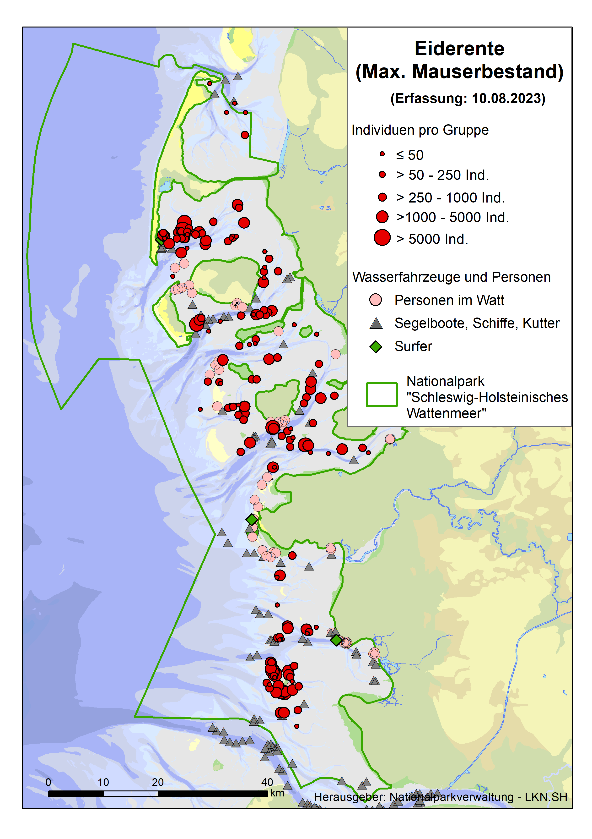
Dieser dienstbezogene Datenbestand für einen WFS-Download-Dienst stellt ab 2009 das Vorkommen und die Individuenanzahlen von Eiderenten aus Zählflügen im Bereich des Nationalparks Schleswig-Holsteinischen Wattenmeer zur Verfügung. Bei den Daten handelt es sich um Sichtungen (Individuenanzahlen) entlang einer bestimmten Flugroute (Punktdaten). Da sich die Meeresenten das ganze Jahr über in den landfernen Bereichen des Wattenmeeres (Nordfriesland und Dithmarschen) aufhalten, werden bei diesem Monitoring vier Zählungen beauftragt, um die Bestände rund um das Jahr zu erfassen. Dieser Geodatensatz des Eiderenten-Monitorings enthält die Daten aller vier Flüge ab dem Jahr 2009, so dass die Variabilität im Jahresverlauf, aber auch zwischen den Jahren abgebildet werden kann (UIG relevant). Diese Daten dienen als Basis, für weitere Datenzusammenstellungen: Winter-Bestand, max. Mauser-Bestand und Herbst -Bestand.
1. Winter-Bestand: eine Erfassung, möglichst im Januar, da zu dieser Zeit kaum Zugereignisse stattfinden, abgestimmt mit der Erfassung der Eiderenten in Niedersachsen, um eine Doppelzählung zu verhindern, falls Individuen zwischen Rastplätzen wechseln.
2. Mauser-Bestand: zwei Erfassungen zur Mauserzeit (Juli-Sept). Für Bewertungen oder fachliche Aussagen wird der Wert des maximalen Mauserbestands benötigt, so dass nur die Daten des Fluges mit der höchsten Anzahl herangezogen werden sollten.
3. Herbst-Bestand als Maximal-Bestand der Rastpopulation der Eiderenten: eine Erfassung im Oktober, da zu dieser Zeit der Herbstzug sein Maximum erreicht. Dieser Wert wird als Bestandsgröße der Rastpopulation verwendet.
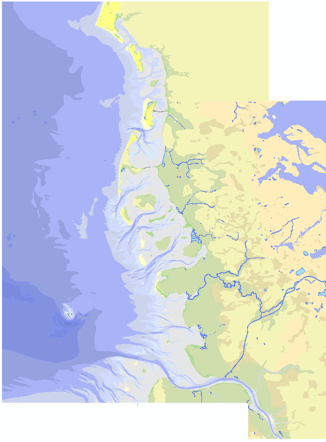
Übersichtskarte Schleswig-Holsteinisches und dänisches Wattenmeer, Polygonshape. Der Wattenmeerbereich beruht vorwiegend auf Tiefeninformationen in Seekarten des BSH. Der Vorlandbereich wird auf Basis der Kartierung der Salzmarschen durch die NP-Verwaltung SH abgeleitet. Die Landbereiche beruhen auf der Interpretation und von Satellitenbildern und Karten und deren Generalisierung.
TMAP parameter group: Area and location of tidal flats and extent of sediment types (in GD). The trilateral Monitoring and Assessment Program was established in 1994 and contains 28 chemical, biological, geological and common parameter. Analyses enable an assessment on the trilateral agreed ecological targets. Results are published as Quality status report regularly. Investigations are done with regard to the following issues of concern primarily (Kellermann, A. et al. 1994): - Effects of climate change on the morphology, - Effects of pollutant inputs (nutrients and contaminants) on processes, species and communities, - Effects of fisheries on species and communities, - Effects of recreational activities on species, - Effects of agricultural utilization on salt marsh communities.
TMAP parameter group: Area and location of different land usage (in GD). The trilateral Monitoring and Assessment Program was established in 1994 and contains 28 chemical, biological, geological and common parameter. Analyses enable an assessment on the trilateral agreed ecological targets. Results are published as Quality status report regularly. Investigations are done with regard to the following issues of concern primarily (Kellermann, A. et al. 1994): - Effects of climate change on the morphology, - Effects of pollutant inputs (nutrients and contaminants) on processes, species and communities, - Effects of fisheries on species and communities, - Effects of recreational activities on species, - Effects of agricultural utilization on salt marsh communities.
TMAP parameter group: Counts of birds washed ashore (BEAB). Data of the Beached-Birds-Survey The trilateral Monitoring and Assessment Program was established in 1994 and contains 28 chemical, biological, geological and common parameter. Analyses enable an assessment on the trilateral agreed ecological targets. Results are published as Quality status report regularly. Investigations are done with regard to the following issues of concern primarily (Kellermann, A. et al. 1994): - Effects of climate change on the morphology, - Effects of pollutant inputs (nutrients and contaminants) on processes, species and communities, - Effects of fisheries on species and communities, - Effects of recreational activities on species, - Effects of agricultural utilization on salt marsh communities.
TMAP parameter group: Counts of birds washed ashore (BEAB). Data of the Beached-Birds-Survey The trilateral Monitoring and Assessment Program was established in 1994 and contains 28 chemical, biological, geological and common parameter. Analyses enable an assessment on the trilateral agreed ecological targets. Results are published as Quality status report regularly. Investigations are done with regard to the following issues of concern primarily (Kellermann, A. et al. 1994): - Effects of climate change on the morphology, - Effects of pollutant inputs (nutrients and contaminants) on processes, species and communities, - Effects of fisheries on species and communities, - Effects of recreational activities on species, - Effects of agricultural utilization on salt marsh communities.
TMAP parameter group: Contaminants in blue mussel (in CD). Gemeinsames Bund/Länder-Messprogramm für die Nordsee The trilateral Monitoring and Assessment Program was established in 1994 and contains 28 chemical, biological, geological and common parameter. Analyses enable an assessment on the trilateral agreed ecological targets. Results are published as Quality status report regularly. Investigations are done with regard to the following issues of concern primarily (Kellermann, A. et al. 1994): - Effects of climate change on the morphology, - Effects of pollutant inputs (nutrients and contaminants) on processes, species and communities, - Effects of fisheries on species and communities, - Effects of recreational activities on species, - Effects of agricultural utilization on salt marsh communities.